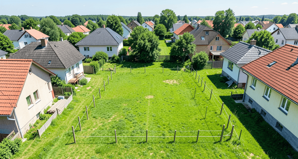
What zoning conditions are and why you need them
A zoning conditions decision (WZ, decyzja o warunkach zabudowy — colloquially “wuzetka”) is an administrative act that defines what may be built on a given plot and to what extent. It is issued under the Act of 27 March 2003 on Spatial Planning and Development (Articles 59-67). WZ acts as a substitute planning instrument: it applies when the plot is not covered by a local zoning plan (MPZP, miejscowy plan zagospodarowania przestrzennego).
MPZP versus WZ — the key difference. A local plan is local law and binds all owners in its area. A WZ decision, by contrast, relates to one specific investment application — it sets development parameters individually, based on an urban analysis of the surroundings. In Poland, more than 30% of residential areas are not covered by a local plan, which means a WZ decision is the only route to a building permit.
Without a WZ decision (or an MPZP in force), the authority will not issue a building permit or accept a construction notification. So if you are considering buying a plot with no local plan, checking your chances of obtaining zoning conditions is one of the first steps. For a complete plot check, see Buying land in Poland: 12 checks before you sign.
When a WZ decision is required — and when it is not
Under Article 59(1) of the Act on Spatial Planning and Development, a zoning conditions decision is required for any change in land development involving the construction of a structure, construction works or a change in the use of a structure — where no local plan is in force.
When is WZ not needed? A WZ decision is not required, among other cases:
- The plot is covered by a local zoning plan in force — then the development parameters come directly from the MPZP.
- A temporary, one-off change of land use lasting up to a year (Article 59(2)).
- Renovations, alterations and extensions that do not require a building permit — as specified in Article 29 of the Construction Law.
- Detached outbuildings, shelters, garden pavilions and conservatories with a footprint of up to 35 m², provided there are no more than two such structures per 500 m² of plot area.
- Farm buildings related to agricultural production on agricultural land (farmstead buildings on an agricultural plot larger than the average farm size in the municipality).
- Technical infrastructure — utility networks, transformer stations, pumping stations.
If you plan to build a single-family house on a plot without an MPZP, you will need a WZ decision virtually every time — regardless of the building’s size.
The urban analysis — the heart of a WZ decision
Every zoning conditions decision rests on an urban analysis (analiza urbanistyczna), required by Article 61(1)(1) of the Act. For a WZ decision to be issued, all of the following conditions must be met at the same time:
- The good neighbourhood rule — at least one neighbouring plot, accessible from the same public road, is developed in a way that lets the authority define requirements for the new building (continuation of function, parameters, features and development indicators).
- Access to a public road — the plot must have direct access to a public road, or access via an internal road or an easement of way.
- Sufficient utilities — existing or planned technical infrastructure (water, electricity, sewerage) is sufficient for the planned investment.
- No change-of-use requirement — the land does not require consent to convert agricultural or forest land to non-agricultural and non-forest use, or such consent has already been obtained.
- Compliance with other regulations — the decision must not breach special rules, e.g. on environmental protection, heritage or protection zones.
The analysed area is the area around the investor’s plot designated by the authority (the wójt, mayor or city president), on the basis of which the permitted parameters of the new building are set. Its minimum size is three times the width of the plot’s frontage, but not less than 50 m from the boundaries of the plot covered by the application. Once the municipality’s general plan (plan ogólny) is in force (from 1 September 2026), the analysed area may not exceed 200 m from the plot boundaries — a significant change that limits the influence of distant buildings on the parameters of the decision.
In practice the planning authority analyses the buildings in the designated area and calculates average parameter values from them — such as height, number of storeys, percentage of site coverage and roof geometry. That is why the neighbourhood matters so much: if the analysed area is dominated by single-family houses 9 m high, you will not get conditions for a four-storey building.
Development parameters in a WZ decision
A zoning conditions decision sets several key parameters that directly affect what building you can design. Each follows from the urban analysis of the plot’s surroundings.
The building intensity ratio is the ratio of the total floor area of buildings (the sum of all above-ground storeys) to the plot area. If the decision sets an intensity of 0.4 and the plot is 1,000 m², the total floor area cannot exceed 400 m². This parameter limits the effective size of the building and the number of storeys.
Detailed rules for calculating this ratio — with an example for a house with a basement, the difference between total and above-ground intensity, and the most common mistakes — are in Building intensity ratio in Poland: how to calculate it.
Maximum site coverage is the share of the building’s footprint in the plot area. With a 25% limit and a 1,000 m² plot, the footprint alone cannot exceed 250 m². Do not confuse it with intensity — coverage concerns only the ground floor, while intensity concerns the whole floor area.
Building height sets the maximum height of the building from ground level to the ridge (the highest point of the roof). Typical values for single-family housing are 9-12 m, which allows a single-storey house with a habitable attic or a two-storey house.
The building line sets the minimum or mandatory distance of the building’s front wall from the road. It can be mandatory (the building must sit on it) or non-exceedable (the building may not be closer to the road). On narrow plots, the building line combined with boundary setbacks can drastically reduce the available building area.
Roof geometry — a WZ decision may specify the permitted roof type (gable, hipped, flat) and pitch angle. This follows from the good neighbourhood rule: if surrounding buildings have gable roofs at 35-45 degrees, the authority will impose a similar form.
Under the 2026 planning reform, the mandatory parameters of a WZ decision also include the share of biologically active area (the minimum percentage of the site covered by greenery) and the minimum number of parking spaces.
How to apply — step by step
The application for a zoning conditions decision is filed by the investor (or their representative) with the executive body of the municipality — the wójt, mayor or city president — competent for the location of the plot. You do not have to own the plot to apply.
Required documents:
- The application on the official form (available on the municipal office’s public information bulletin (BIP) website or via the ePUAP platform).
- A copy of the base map (or cadastral map) at a scale of 1:500 or 1:1000, issued by the county surveying office. Submit it in two copies — one for the case file and one to carry the decision’s determinations.
- A description of the planned investment: type of development (single-family, multi-family, commercial), approximate building parameters (footprint, height, number of storeys), and how wastewater and water supply will be handled.
- Documents confirming the possibility of connecting to technical infrastructure (connection conditions or confirmation of utility supply from network operators) — if the office requires them.
- A power of attorney — if a representative files the application (plus a PLN 17 stamp duty for the power of attorney).
The stamp duty for issuing a WZ decision is PLN 598 (about EUR 140). Owners and perpetual usufructuaries of the plot are exempt. The exemption also applies to public benefit organisations, budgetary units and local government units. Proof of payment must be attached to the application or delivered within 3 days of filing.
Before filing, check whether the plot meets the Article 61 conditions at all — it saves time and money. The plot verification checklist will help you spot potential obstacles.
How long it takes and what it costs
The statutory deadline for issuing a zoning conditions decision is 90 days from the filing of a complete application. For detached single-family houses with a footprint of up to 70 m² (built on notification), the deadline is cut to 21 days. These deadlines do not include periods of suspended proceedings, waiting for opinions from other authorities, or time allowed to correct formal deficiencies.
Practice is different. In large cities (Warsaw, Kraków, Wrocław, Gdańsk), waiting for a WZ decision typically takes 4 to 8 months, and in extreme cases more than a year. The main causes of delay are the volume of applications at the offices, the need for opinions from the heritage conservator, the road authority, Polish Waters or other bodies, and the applicant supplementing documentation.
Total cost of the WZ procedure:
- Stamp duty for the decision: PLN 598 (owners and perpetual usufructuaries are exempt).
- Base/cadastral map: about PLN 100-300 (depending on the county surveying office).
- Power of attorney (optional): PLN 17.
- A planner or architect handling the case (optional): about PLN 1,500-4,000 (about EUR 350-930) — a professional will prepare the application, the project description and any appeal.
Filing the application yourself (without professional help) typically costs PLN 700-900 (about EUR 160-210). If you hire a specialist, the total can reach PLN 2,000-5,000 (about EUR 465-1,160).
If zoning conditions are refused — what next
The authority may refuse to issue a zoning conditions decision if even one of the five Article 61 conditions is not met. The most common reasons for refusal are:
- The good neighbourhood rule is not met — there is no development in the analysed area that would allow the parameters of the new investment to be defined, or the planned structure departs radically from existing development.
- No access to a public road — the plot does not border a public road and has neither an established easement of way nor an internal road.
- Insufficient utilities — it is not possible to connect to the water, sewer or electricity network, and the investor has not presented an alternative (e.g. a well, septic tank or domestic wastewater treatment plant).
- Change-of-use requirement — the land is classified as agricultural (classes I-III) and requires a decision changing its designation, which has not been issued.
- Conflict with other regulations — the plot lies in a heritage protection zone, the Q100 flood zone or is subject to other restrictions.
Appeal to the SKO. A decision refusing zoning conditions can be appealed to the Local Government Appeals Board (SKO, Samorządowe Kolegium Odwoławcze) within 14 days of delivery. The appeal is filed through the authority that issued the decision (the wójt, mayor or city president). You do not have to give detailed reasons — it is enough to express disagreement with the ruling — but solid arguments significantly improve the chances of changing the decision.
The SKO can uphold the decision, quash it and remit the case for reconsideration, or quash it and decide the matter itself. If the SKO also refuses, you can file a complaint with the regional administrative court within 30 days of delivery of the SKO’s decision.
The 2026 reform — how zoning conditions are changing
The amendment to the Act on Spatial Planning and Development of 7 July 2023 introduces fundamental changes to the system for issuing zoning conditions decisions. The reform takes effect in stages — the key dates are 1 January 2026 and 1 July 2026.
5-year validity of WZ decisions. From 1 January 2026, new zoning conditions decisions expire 5 years after they become final. This is the end of open-ended “wuzetki”: the investor must start the project (obtain a building permit or file a notification) within 5 years, otherwise the decision loses force. Decisions issued in proceedings initiated before 16 October 2025 remain valid indefinitely.
The municipal general plan. Every municipality was obliged to adopt a general plan (plan ogólny) by 31 August 2026. The general plan replaces the previous study of conditions and directions of spatial development. From 1 September 2026, a WZ decision can be issued only in areas designated in the general plan as infill development areas. Municipalities that did not adopt a general plan by the deadline cannot issue new WZ decisions or adopt new local plans.
The deadline passed on 31 August 2026 — about 35% of municipalities made it. What this means for new and already-filed WZ applications is explained in Municipalities without a general plan after 1 September 2026.
A new analysed area. Once the general plan is in force, the analysed area for a WZ decision may not exceed 200 m from the plot boundaries. This is a significant limit — until now, for wide plots the analysed area could extend several hundred metres, allowing distant buildings to be taken into account.
For more on the planning reform — including new planning zones, the abolition of the study and the consequences for investors — read Poland’s 2026 planning reform.
How Zabudowa.com.pl automates the WZ analysis
Verifying zoning conditions means gathering data from several sources: the geoportal, the land and buildings register, ISOK flood maps, the BDOT10k database (neighbouring buildings), the base map and the register of local plans. Searching these systems by hand takes hours — and interpreting the results takes planning expertise.
Zabudowa.com.pl (interface in Polish) automates this process. Enter the cadastral plot number and within minutes the platform will:
- Retrieve the plot boundaries from the ULDK register and display them on a map.
- Check whether the plot is covered by an MPZP — and if so, retrieve the development parameters from the local plan.
- Analyse the neighbourhood using BDOT10k data (buildings within up to 200 m) and calculate average parameters of the surroundings — analogous to an urban analysis.
- Verify flood risk zones (ISOK) and the presence of underground infrastructure (GESUT).
- Generate building variants compliant with 52 validation rules, covering boundary distances, building lines, site coverage and intensity.
- Prepare a PDF report with the parameters and a site plan drawing — ready to attach to an application or to take to an architect.
The tool is especially useful for real estate agents assessing the potential of plots, architects preparing preliminary concepts, and private investors planning a house.
Check your plot for free — enter the cadastral plot number and see which development parameters are possible on your land.
Check your plot
Enter the plot number and find out in 2 minutes what you can build on it. Free, no sign-up. (The analysis tool is in Polish and covers Polish plots.)
Analyze a plot for freeRelated articles
No General Plan, No Zoning Decision? Building in Poland After 1 September 2026
The deadline for municipal general plans passed on 31 Aug 2026 and only 35% of municipalities made it. Can you still get a WZ zoning decision? Rules, next steps.
Building Intensity Ratio in Poland: What It Is and How to Calculate It (With Example)
Polish building intensity ratio explained step by step: the statutory definition, above-ground vs total intensity, a worked example and permit-blocking mistakes.
Buying Land in Poland: 12 Checks That Can Save You Thousands
A 12-point checklist for buying building land in Poland: local zoning plan, zoning conditions, utilities, road access, soil, flood risk and land register.